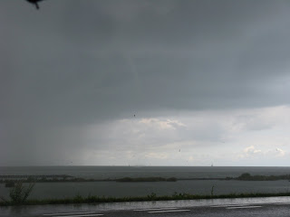
My Sunday's - by the way- are always set apart for enjoying the things of God. That's why I and my little family after first having heard an exposition of God's Word to people afterwards drove to the "IJ- en Markermeer" to have a familymoment, a walk and probably some nice weather.
Already at our arrival before 12.00 the skies looked promising and soon we saw a short funnel above the IJmeer. Going more Northward from 13.50 pm LT I stopped at a parking place because of forming funnels. They persisted, became broader and southeast and later northwest of them two others formed but quickly disappeared.
The most right one came in the course of time closeby and showed a wonderfull circulation on the watersurface. Notice: this was nearly half an hour after the first appearence of the 'two funnels'. Only when coming closeby the rainfall became excessive; so the nearby photo's are somewhat blurried. Through the open car-window I myself got a totally rain- drenched shirt; but what matters....
Estofex forecast: "... Benelux, Germany, Switzerland, N-Italy and parts of Austria ...
Cold-core upper low moves slowly to the east/southeast atop a northeastward surging warm/moist LL air mass, so conditions will be supportive for widespread thunderstorm initiation. With cooling 850 temperatures and a warm/moist boundary layer, abundant LL CAPE will be present in the level 1. Background shear remains weak with LCLs at or below 800 m, so numerous funnel/tornado reports seem possible with more persistent updrafts. In addition, slow storm motion and mean mixing ratio at or above 10 g/kg in the lowest 1000 m point to an augmented heavy rainfall risk with training or backbuilding storms, mainly over Benelux all the way to central Germany........"
The convection behind became the funnel and spout producer
Again another short funnel....
  |
| Seeing for real what daddy's sometimes talking about... | <><><><><><><><>


